Autores
Karina Lalangui1,2, Max Cotera-Mantilla1, Marco Sánchez-Murillo1, Alex Carrera-Alvarez1, Mónica Duque-Cuasapaz1Emmanuelle Quentin2
1Centro de Investigación EpiSIG, Instituto Nacional de Investigación en Salud Pública, Quito, Ecuador
2Centro de Investigación en Salud Pública y Epidemiología Clínica (CISPEC), Facultad Ciencias de la Salud Eugenio Espejo, Universidad UTE, Quito, Ecuador.
Resumen:
Intestinal infectious diseases are a global concern in terms of morbidity, and they are closely linked to socioeconomic variables such as quality of life, weather and access to healthcare services. Despite progress in spatial analysis tools and geographic information systems in epidemiology, studies in Ecuador that evaluate temporal trends, specific geographic groups, and their correlation with socioeconomic variables are lacking. The absence of such information makes it challenging to formulate public health policies. This study sought to identify the spatial and temporal patterns of these diseases in Ecuador, along with their correlation with socioeconomic variables. In Ecuador, the study was carried out in a continental territory, focusing on data related to intestinal infectious diseases collected from the National Institute of Statistics and Census (Instituto Nacional de Estadística y Censos) during the period from 2014 to 2019. This study involved spatial and temporal analyses using tools such as the global Moran’s index and Local Indicators of Spatial Association to identify spatial clustering patterns and autocorrelation. Additionally, correlations between morbidity rates and socioeconomic variables were examined. During the investigated period, Ecuador registered 209,668 cases of these diseases. Notable variations in case numbers were identified, with a 9.2% increase in 2019 compared to the previous year. The most impacted group was children under 5 years old, and the highest rates were centered in the southern and southwestern regions of the country, with Limón Indanza and Chunchi being the cantons with the highest rates, notably showing a significant increase in Limón Indanza. Additionally, there were significant correlations between morbidity rates and socioeconomic variables, school dropout rates, low birth weight, and access to water services. This study emphasizes the importance of considering socioeconomic variables when addressing these diseases in Ecuador. Understanding these correlations and geospatial trends can guide the development of health policies and specific intervention programs to reduce the incidence in identified highrisk areas. More specific research is needed to understand the underlying causes of variability in morbidity and develop effective prevention strategies.
Autores
Karina Lalangui1, Karina Rivadeneira Maya2, Christian Sánchez‑Carrillo3, Gersain Sosa Cortéz3, Emmanuelle Quentin4
1Instituto Nacional de Investigación en Salud Pública “Leopoldo Izquieta Pérez”, Centro de Investigación de Epidemiología, Geomática, Bioestadística y Bioinformática (EpiSIG), Quito 170136, Ecuador.
Resumen:
The infant mortality rate (IMR) is still a key indicator in a middle-income country such as Ecuador where a slightly increase up to 11.75 deaths per thousand life births has been observed in 2019. The purpose of this study is to propose and apply a prioritization method that combines clusters detection (Local Indicators of Spatial Association, LISA) and a monotonic statistic depicting time trend over 10 years (Mann–Kendall) at municipal level. Annual national databases (2010 to 2019) of live births and general deaths are downloaded from National Institute of Statistics and Censuses (INEC). The results allow identifying a slight increase in the IMR at the national level from 9.85‰ in 2014 to 11.75‰ in 2019, neonatal mortality accounted for 60% of the IMR in the last year. The LISA analysis allowed observing that the high-high clusters are mainly concentrated in the central highlands. At the local level, Piñas, Cuenca, Ibarra and Babahoyo registered the highest growth trends (0.7,1). The combination of techniques made it possible to iden‑tify eight priority counties, half of them pertaining to the highlands region, two to the coastal region and two to the Amazon region. To keep infant mortality at a low level is necessary to prioritize critical areas where public allocation of funds should be concentrated and formulation of policies.
Autores
Cotera-Mantilla, Max1, Marco Sánchez-Murillo1, Lalangui, Karina1
1Instituto Nacional de Investigación en Salud Pública “Leopoldo Izquieta Pérez”, Centro de Investigación de Epidemiología, Geomática, Bioestadística y Bioinformática (EpiSIG), Quito 170136, Ecuador.
Resumen:
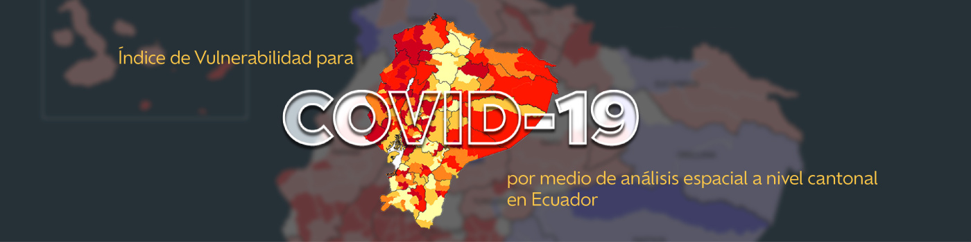
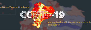
El establecimiento de índices de enfermedad a nivel espacial, en áreas geográficas específicas, con base en indicadores preestablecidos, permite inferir en la población y sustentar la toma
de decisiones. Objetivo: establecer un índice de vulnerabilidad para COVID-19 por medio de análisis espacial a nivel cantonal en Ecuador. Metodología: por medio de un estudio
exploratorio transversal, se calculó un índice de vulnerabilidad, a nivel cantonal, con un modelo jerárquico aditivo compuesto y otro por componentes principales, basado en 13
indicadores, en cuatro dimensiones: demográfica, epidemiológica, infraestructura de salud y socioeconómica. Se utilizó un método de clasificación en quintiles, un quintil más alto denota
mayor puntuación de vulnerabilidad relativa y se presentan los resultados por graficación espacial. Resultados: Se obtuvieron 2 tablas de los 221 cantones en el Ecuador, con las que
se construyeron 2 modelos de vulnerabilidad con distintas valoraciones según cada cantón.
Autores
Marco Sánchez-Murillo124, Sarah Martin-Solano345, Gabriel Carrillo-Bilbao46, Maritza CeliErazo1, Nancy Cueva-Salazar2*
1Instituto Nacional de Investigación en Salud Pública “Leopoldo Izquieta Pérez”, Centro de Investigación de Epidemiología, Geomática, Bioestadística y Bioinformática (EpiSIG), Quito 170136, Ecuador. 2 Universidad Técnica de Cotopaxi, Carrera de Medicina Veterinaria, Latacunga, Cotopaxi, Ecuador.3 Primatology Research Group, Behavioural Biology Unit, Department of Biology, Ecology and Evolution, Faculty of Science, University of Liège, Quai van Beneden 22, 4020 Liège, Belgium. 4 Instituto de Investigación en Zoonosis- CIZ, Universidad Central del Ecuador, Quito 170521, Ecuador. 5 Grupo de Investigación en Sanidad Animal y Humana (GISAH), Departamento de Ciencias de la Vida y de la Agricultura, Universidad de las Fuerzas Armadas ESPE, Sangolquí 171103, Ecuador. 6 Research Unit of Epidemiology and Risk Analysis Applied to Veterinary Sciences (UREAR-ULg), Fundamental and Applied Research for Animal and Health (FARAH) Center, Department of Infections and Parasitic Diseases, Faculty of Veterinary Medicine, University of Liège, B-4000 Liège, Belgium
Resumen:
La parasitosis gastrointestinal en primates no humanos demuestra ser una patología frecuente en Medios de Conservación y Manejo Ex Situ (MCME) en el Ecuador y puede ser un factor que imposibilite la rehabilitación y reintroducción. El objetivo de esta investigación fue determinar géneros de parásitos gastrointestinales, presentes en primates de MCME en la Amazonía Ecuatoriana, mediante exámenes coprológicos para diferenciar taxonómicamente a los parásitos gastrointestinales y determinar el manejo sanitario más adecuado de cada MCME en base al estudio. La investigación fue de tipo descriptiva explicativa, con metodología inductiva-deductiva y un diseño de tipo documental, campo y laboratorio. Mediante un muestreo no invasivo de recolección fecal seriada (tres días consecutivos/primate), se tomaron muestras fecales de 62 primates, con solución de formalina al 10% buferada con PBS. Se analizó en laboratorio cada muestra mediante métodos de sedimentación y flotacion fecal. Los parásitos gastrointestinales detectados corresponden a Strongyloides sp. (43.6%), Ancylostoma/Necator/Uncynaria (12.9%), Strongylus tipo (22.6%,) grupos que presentaron alta morbilidad y Prosthenorchis sp. (14.5%) el cual incurrió en una marcada mortalidad. Este último no respondió a los tratamientos aplicados. Considerando la patogenia de cada parásito, se aplicó un tratamiento a primates con altas cargas de parásitos, priorizando así el desarrollo de la inmunidad, y evitando la desparasitación arbitraria. Algunas especies parasitarias pueden mantener un equilibrio con su hospedador primate mientras no se encuentre inmunodeprimido y se realice una limpieza y sanitización adecuada, como es el caso de Strongyloides sp. y otras especies parasitarias. En el caso de Prosthenorchis sp. representa un problema grave de salud evidenciando una mortalidad del 100% en pequeños primates neotropicales como Saimiri sp., Cebuella sp. o Leontocebus sp.
Autores
Thien-An Ha, Tomás M. León, Karina Lalangui, Patricio Ponce, John M. Marshall & Varsovia Cevallos
Lugar de presentación
Parasites & Vectors, Sep2021
Resumen
Aedes aegypti, also known as the yellow fever mosquito, is the main vector of several arboviruses. In Ecuador, dengue and chikungunya are the most prevalent mosquito-borne diseases. Hence, there is a need to understand the population dynamics and genetic structure of the vector in tropical areas for a better approach towards effective vector control programs. This study aimed to assess the genetic diversity of Ae. aegypti, through the analyses of the mitochondrial gene ND4, using a combination of phylogenetic and population genetic structure from 17 sites in Ecuador. Results showed two haplotypes in the Ecuadorian populations of Ae. aegypti. Haplotype 1 was closely related to Ae. aegypti reported from America, Asia, and West Africa. Haplotype 2 was only related to samples from America. The sampled vectors from the diverse localities showed low nucleotide diversity (π = 0–0.01685) and genetic differentiation (FST = 0.152). AMOVA analyses indicated that most of the variation (85–91%) occurred within populations, suggesting that geographical barriers have little effect on the genetic structure of Ecuadorian populations of Ae. aegypti. These results agree with the one main population (K = 1) detected by Structure. Vector genetic identity may be a key factor in the planning of vector control strategies.
Más información
Autores
Solón A Orlando, Vanessa F Panchana, Joselyn L Calderón, Olga S Muñoz, Dédime N Campos, Pablo R Torres-Lasso, Fabrizio J Arcos, Emmanuelle Quentin
Lugar de presentación
Vector-Borne and Zoonotic Diseases, May2019
Resumen
In recent years, there has been an increasing risk of hematophagous bat attacks in Latin America, where livestock production is a basic source of food for local populations. In Ecuador, livestock represented an important part of agricultural output. Some cases of cattle bitten by bats in the province of Santa Elena have been reported; however, no previous studies have been conducted to determine the magnitude of the attacks and the associated risk factors. In this research, a cross-sectional descriptive study was performed recording attacks of hematophagous bats (Desmodus rotundus) through visual inspection of livestock and the capture of specimens by mist nets. Generally, the prevalence of D. rotundus attacks on farms was 69%, whereas attacks on bovine had 24% of prevalence. From the captured specimens, 93% were identified as D. rotundus and within the 30% of the captured D. rotundus, no infections for rabies virus were diagnosed. The univariable analysis used for estimating the risk factors associated with bat attacks showed that corrals away from populated centers present the highest risk (odds ratio [OR] = 19.864; p = 0.0004), followed by tree density >30 per hectare (OR = 16.313; p < 0.0001) and predatory birds of bats (OR = 15.375; p < 0.0001); a binary logistic regression model showed ‘‘corrals away from populated centers’’ (OR = 23.47; p = 0.006) as the main risk factor. Linear regression analysis showed good correlation between the number of bovines attacked and the number of bites (R = 0.977; p < 0.0001) suggesting some feeding patterns of D. rotundus. This study could be used as a starting point for understanding the feeding habits of D. rotundus and factors governing their attacks in coastal regions of Ecuador, and potential occurrences of rabies infections. With this knowledge, surveillance and control programs can be supported to improve rabies transmission monitoring.
Más información
Autores
VK López ,BT Oeste ,P. J. Clarke ,E. Quintín yJNS Eisenberg
Lugar de presentación
BMC Public Health, Ene2019
Resumen
Globally, diarrhea is a leading cause of child morbidity and mortality. Although latrines are integral for reducing enteric pathogen transmission, several studies have shown no evidence that latrine ownership improved child health. There are a number of explanations for these results. One explanation is that latrine access does not equate to latrine use. Latrine use, however, is difficult to accurately ascertain, as defecation behavior is often stigmatized. To address this measurement issue, we measure latrine use as a latent variable, indicated by a suite of psychosocial variables.
Más información
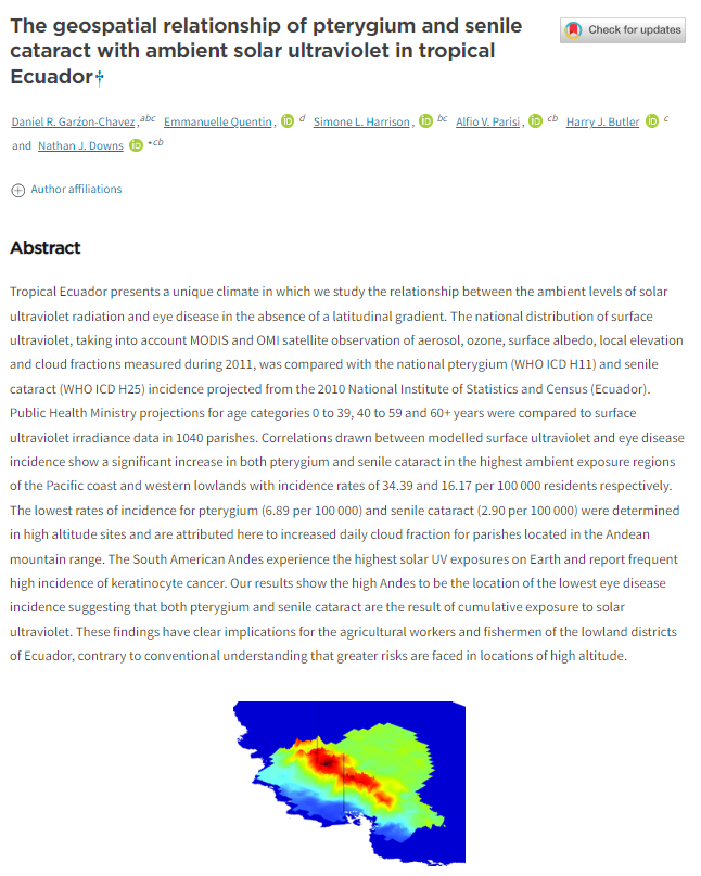
Autores
Daniel R Garźon-Chavez 1, Emmanuelle Quentin, Simone L Harrison, Alfio V Parisi, Harry J Butler, Nathan J Downs
Lugar de presentación
Photochem. Photobiol. Sci.,2018, 17, 1075, Jun2018
Resumen
Tropical Ecuador presents a unique climate in which we study the relationship between the ambient levels of solar ultraviolet radiation and eye disease in the absence of a latitudinal gradient. The national distribution of surface ultraviolet, taking into account MODIS and OMI satellite observation of aerosol, ozone, surface albedo, local elevation and cloud fractions measured during 2011, was compared with the national pterygium (WHO ICD H11) and senile cataract (WHO ICD H25) incidence projected from the 2010 National Institute of Statistics and Census (Ecuador). Public Health Ministry projections for age categories 0 to 39, 40 to 59 and 60+ years were compared to surface ultraviolet irradiance data in 1040 parishes. Correlations drawn between modelled surface ultraviolet and eye disease incidence show a significant increase in both pterygium and senile cataract in the highest ambient exposure regions of the Pacific coast and western lowlands with incidence rates of 34.39 and 16.17 per 100 000 residents respectively. The lowest rates of incidence for pterygium (6.89 per 100 000) and senile cataract (2.90 per 100 000) were determined in high altitude sites and are attributed here to increased daily cloud fraction for parishes located in the Andean mountain range. The South American Andes experience the highest solar UV exposures on Earth and report frequent high incidence of keratinocyte cancer. Our results show the high Andes to be the location of the lowest eye disease incidence suggesting that both pterygium and senile cataract are the result of cumulative exposure to solar ultraviolet. These findings have clear implications for the agricultural workers and fishermen of the lowland districts of Ecuador, contrary to conventional understanding that greater risks are faced in locations of high altitude.
Autores
A. Alvarado, M. V. Esteller, E. Quentin & J. L. Expósito
Lugar de presentación
Water Resources Management, Ene2016
Resumen
This work presents the use of multi-criteria decision analysis (MCDA) as a decision tool to facilitate the process of prioritization of drinking wells that would need more protection before contamination risk. In this study, three aspects of the protection of the groundwater quality were taken into account: natural, anthropic and technical. From these aspects, elements more representative were selected, which can be quantified with available and easily accessible information. Considering those elements, selection criteria were defined which have been represented by: population distribution indicator, human development index, land use, index for aquifer vulnerability to contamination, well age and well yearly pumping rate. The developed method has been applied to drinking supply wells located in the Toluca Valley aquifer (Mexico), and implied the generation of the thematic maps of the defined selection criteria. For the MCDA, the values of each map were converted to the same scale, each criterion was weighted in function of its importance according to the objective and there were aggregated by the way of a lineal combination. The obtained result is a map that shows the level of protection priority of the supply wells. This map can offer information to the stakeholder in a relative short time and contribute to accelerate the actions aimed to protect the quality of the vital underground liquid.
Autores
Solón A. Orlando1,2, Vanessa F. Panchana3, Joselyn L. Calderón1, Olga S. Muñoz1, Dédime N. Campos2, Pablo R. Torres-Lasso4, Fabrizio J. Arcos2, and Emmanuelle Quentin1
1Instituto Nacional de Investigación en Salud Pública (INSPI), Guayaquil, Ecuador.
2Facultad de Medicina Veterinaria y Zootecnia, Universidad Agraria del Ecuador, Guayaquil, Ecuador.
3Agencia Ecuatoriana de Aseguramiento de la Calidad Agro (AGROCALIDAD), Santa Elena, Ecuador.
4Facultad de Medicina Veterinaria y Zootecnia, Universidad de Guayaquil, Guayaquil, Ecuador.
Lugar de presentación
Vector-Borne and Zoonotic Diseases, ISSN 15303667, Guayaquil, Ecuador, Mar2019
Resumen
In recent years, there has been an increasing risk of hematophagous bat attacks in Latin America, where livestock production is a basic source of food for local populations. In Ecuador, livestock represented an important part of agricultural output. Some cases of cattle bitten by bats in the province of Santa Elena have been reported; however, no previous studies have been conducted to determine the magnitude of the attacks and the associated risk factors. In this research, a cross-sectional descriptive study was performed recording attacks of hematophagous bats (Desmodus rotundus) through visual inspection of livestock and the capture of specimens by mist nets. Generally, the prevalence of D. rotundus attacks on farms was 69%, whereas attacks on bovine had 24% of prevalence. From the captured specimens, 93% were identified as D. rotundus and within the 30% of the captured D. rotundus, no infections for rabies virus were diagnosed.
Autores
Andrea Lobato-Cordero1, Emmanuelle Quentin2, and Gina Lobato-Cordero3
1Instituto de Investigacion Geologico y Energetico (IIGE), Quito, Ecuador
2Instituto Nacional de Investigación en Salud Pública (INSPI), Centro de Investigación EpiSIG, Quito, Ecuador.
3Universidade Federal de Uberlandia (UFU), Uberlandia, Brazil
Lugar de presentación
Journal of Environmental and Public Health, ISSN 16879805, 16879813, Egypt, Sep2019
Resumen
The external environment directly influences human health. However, what happens inside? ‘is work deals with the effect that the interior thermal variables have on the propagation of respiratory diseases and focused on the relation of the temperature and relative humidity inside social housing in the 1040 parishes of Ecuador and the transmission of influenza. On the one hand, historical weather-related variables were used to simulate and estimate the interior conditions, and thresholds on temperature and humidity were determined. On the other hand, the health-related variable was determined by analyzing the statistics corresponding to the influenza and viral pneumonia in 2009 since that year was critical for these diseases; the data were divided by month for each parish. Finally, the correlation of these variables determines the relative importance of the interior conditions on the respiratory health of its inhabitants. ‘e preliminary results indicate that the places with the lowest temperatures and relative humidity could favor the virus transmission. Also, the analysis indicated that respiratory diseases increase in August and October. In this way, it is clear that social housing projects in Ecuador require a study which guarantees not only energy efficiency and sustainability related issues but also the well-being of their inhabitants.
Más información
Autores
V. K. Lopez1 , B. T. West1, P. J. Clarke1,2, E. Quentin3 and J. N. S. Eisenberg1
Lugar de presentación
Revista BMC Public Health, ISSN 1471-2458, United Kingdom, Ene2019
Resumen
Globally, diarrhea is a leading cause of child morbidity and mortality. Although latrines are integral for reducing enteric pathogen transmission, several studies have shown no evidence that latrine ownership improved child health. There are a number of explanations for these results. One explanation is that latrine access does not equate to latrine use. Latrine use, however, is difficult to accurately ascertain, as defecation behavior is often stigmatized. To address this measurement issue, we measure latrine use as a latent variable, indicated by a suite of psychosocial variables.
Más información
Autores
Luis Balcázar1, Khalidou M. Bâ1, Carlos Díaz-Delgado1, Emmanuelle Quentin2, Saula Minga-León1
1Instituto Interamericano de Tecnología y Ciencias del Agua (IITCA). Universidad Autónoma del Estado de México, Instituto Literario # 100. C.P. 50000 Colonia Centro, Toluca México. (lebalcazar@gmail.com, khalidou@uaemex.mx, cdiazd@uaemex.mx, saula.vero@gmail.com) 2Plataforma EpiSIG. Instituto Nacional de Investigación en Salud Pública (INSPI), Calle Iquique N14-285 y Yaguachi, C.P. 170403, Quito, Ecuador. (emmanuelle.quentin@gmail. com)
Lugar de presentación
Revista AGROCIENCIA, ISSN 1405-3195, MÉXICO, Jun2019
Resumen
En algunas regiones del mundo, como el sur del Ecuador, los datos meteorológicos son escasos o no existen. Sin embargo, los datos de los productos estimados por satélite son una alternativa en estos lugares y en áreas remotas pueden ser la única fuente de infor- mación disponible.
Más información
Autores
Emmanuelle Quentin, PhD.
Plataforma EpiSIG-Instituto de Investigación en Salud Pública INSPI
Lugar de presentación
Boletín Red GESIG, Diciembre 2017
Resumen
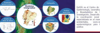
Para estar en capacidad de tomar decisiones adecuadas en salud, hay que contar con modelos que intregren todos los aspectos involucrados y los vínculos entre ellos.
Más información de Red GESIG
[:en]
[:fr]
[:]